 |
| Daily Boston Globe headline, October 1955, after the demolition of the New York Streets neighborhood |
In the 1950s, the city of Boston started to investigate the possibility of redeveloping certain neighborhoods that they believed were run down. Several potential sites were located in the South End. An urban renewal effort was going on throughout the United States and was encouraged by both the federal and local governments in many major cities.
The first area targeted for redevelopment in the South End was the neighborhood known as the New York Streets, the area between Harrison Ave., Albany Street, Dover (now East Berkeley) Street, and Motte (now Herald) Street. The Boston Housing Authority (the predecessor to the Boston Redevelopment Authority) issued a report on the condition of the New York Streets in June, 1952:

Hundreds of families lived in the New York Streets area, so called because the streets were named after places in New York State that a Boston railway line ran through: Troy, Rochester, Genesee, Oswego, Oneida, Seneca, and Rose (See Mark B.’s remark in the comment section below for detail about Rose Street). Gloria Ganno, a former resident, recalled her time growing up in the New York Streets:
For Cathedral Housing, the BRA razed the existing structures on the site and built a housing development there in the 1950s to house WWII veterans and their families. In the early 1960s, residents of the Castle Square neighborhood were evicted and their buildings destroyed. Debates about proposed redevelopment for the area ensued and eventually an affordable housing block was built on the site. The result, Castle Square apartments, still stands there today.
 |
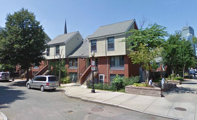
| Tent City, corner of Dartmouth and Columbus, Google Map |
During this period, many South End residents feared that urban renewal would lead to higher property values and that the city was not guaranteeing enough affordable housing. They feared that they would be pushed out of the South End. Some organized and fought for affordable housing. A famous example is Tent City, a housing development on the corner of Dartmouth Street and Columbus Avenue. The city cleared the area of buildings in 1968 with the intention of constructing a parking garage. Frustrated with the lack of assistance by the city for people being displaced by urban renewal projects and the lack of attention to the need for affordable housing in the South End, protestors occupied the lot, pitched tents, and camped there for three days. The protestors won, but not without a long and drawn out battle. The city did build affordable housing on the site and opened it…in 1988, twenty years after the initial protest. But nonetheless, the building was christened Tent City in honor of the efforts there in 1968.
 |
| Villa Victoria, Google Map |
Affordable housing was also built in several other places. Large brick buildings like Concord House and Methunion occupy long blocks on Washington Street, Columbus Avenue, and Tremont Street. Another famous example of organized protest is Villa Victoria, which takes up several blocks around West Dedham St. and West Brookline St. in between Shawmut Ave. and Tremont St. The city wanted to tear down the buildings and rehouse the tenants elsewhere. The residents, a predominantly Puerto Rican population, organized in protest and fought and won the right to design a new housing development on the site. Villa Victoria, an award-winning urban design, was the result.
 |
| 1972 image of Washington Street, courtesy of the South End Historical Society. |
The SEHS formed in 1966 to preserve the South End’s Victorian rowhouses and other historic architecture. In 1972, the SEHS filed an application to place the South End district on the National Register of Historic Places. They were successful. The application included about 3,000 images of South End buildings, which the SEHS retains in its collections.
Rose street wasn’t laid out until decades after the New York streets were there. When the New York street were laid out, the location that is was later Rose street was a pier that extended from Harrison avenue. Later, the block between Troy and Dover streets was filled in out beyond Albany street. Still later, that wide block was bisected by Rose street.
Mel King grew up in the New York streets neighborhood, and has written about it. One of Boston’s few truly integrated neighborhoods, and they had to slander it to destroy it. In all these projects, no one ever asked the people who lived there what their opinion was.
Mel King released a book that talks a bit about his time there and he might have done an oral history at United South End Settlements..although I’m not sure if he talked about NYStreets in that. We did an oral history with one former resident, Gloria Ganno, and the West End Museum is planning an exhibit on the New York Streets for the fall. There are a few people in the South End still who lived there and talk about it. Thanks for the info on Rose Street!